
As one of the 9 National Parks in Taiwan, Yangmingshan stretches from Taipei to New Taipei. It is famous for Taiwan’s highest dormant Qixing volcano (1,120m), beautiful trails, hot springs, and diverse landscapes.
Initially, this mountain range was called the Grass Mountain because Qing Dynasty officials were worried about sulfur theft; they often set fire to the mountain. Therefore, there was only grass and almost no trees on the Yangmingshan. Under Japanese rule, it became Taiwan’s first national park and was established on December 27, 1937, as Daiton National Park. In 1950, President Chiang Kai-shek changed the Grass Mountain to Yangmingshan to commemorate scholar Wang Yangming of the Ming Dynasty. It is the reason that we often know this mountain range in Vietnamese as Duong Minh Son.
We arrived at Yangmingshan on a sunny April day and were immediately captivated and overwhelmed by the large space of this place. Although we read a lot of information and carefully checked the map, we still got lost initially among many turns. One turn leads to the flower garden at the foot of the mountain; the other turn leads to the path through the local village. The different turn splits into many ways to conquer many distant peaks. We caught the bus, walked, and then returned to the beginning. Finally, we decided to stop using Google Maps and aim straight at the peak of rising smoke. That’s Xiaoyoukeng.
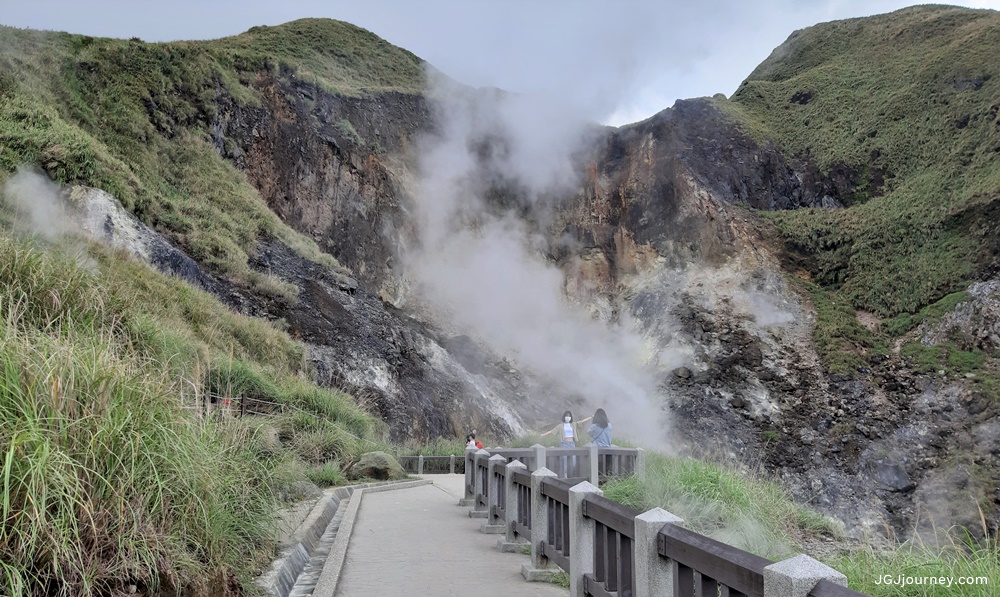
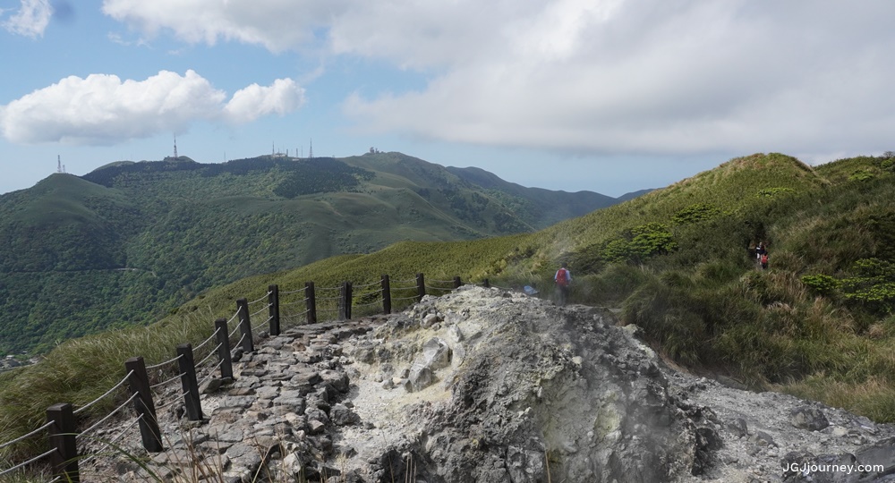
Xiaoyoukeng is a post-volcanic geological landscape at an altitude of more than 800m above sea level. Xiaoyoukeng is famous for fumaroles, sulfur crystals, hot springs, and landslide terrain that was formed by post-volcanic activity.
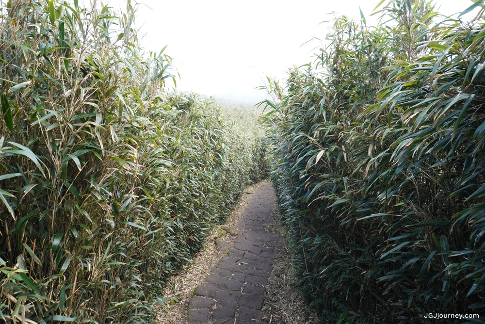
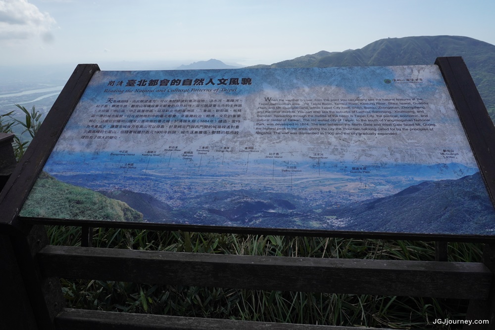
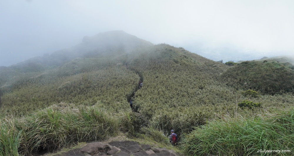
We continued the hiking trail from the Xiaoyoukeng parking lot to conquer Qixing Peak, also known as Seven Star Mountain, the tallest dormant volcano in Taiwan. The flora of the route from Xiaoyoukeng is mostly bamboo and grass. Moreover, the smell of sulfur is quite strong. After every short distance, we saw warning signs at fumaroles. The higher we climbed up, the lighter the sulfur smell was. And a view of Taipei and New Taipei among streams was opeened. The National Park attaches a kilometer sign in each route’s section and explains flora and fauna via a board. In addition, the National Park also designs an observation area with clear instructions to see which river and which districts.
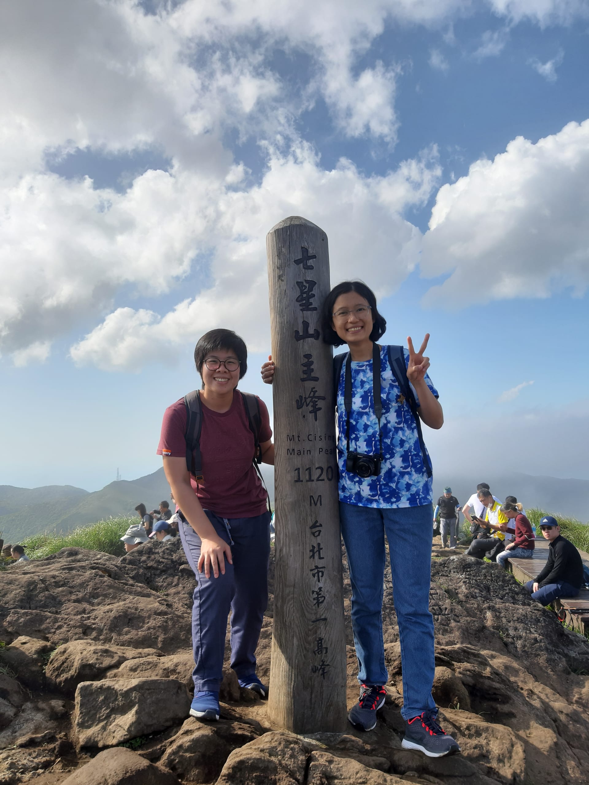
After more than an hour of leisurely walking, we reached the peak of Qixing mountain in a cool breeze and cloudy weather. There are not only signs indicating the direction and information about the mountain, but the National Park also attaches a block marking the top and a wooden pillar. When climbing there, most people wanted to take photos with the pillar to save in their trekking collection. Tourists, locals and foreigners, lined up and helped each other record memories. Everyone was gentle and very cute. For our turn, the sun suddenly started to shine. The Taiwanese friends queuing up cheered loudly. They helped us capture that beautiful moment. The camera flashed, beaming smile came.
Going down the mountain in the late afternoon, we did not return to the old route but chose Lengshuikeng, looking forward to experiencing more. As a result, you have to go down the valley, then up a nearby mountain, and then down. In return, flora and fauna are diverse and change many different colors with altitude. The fresh air smelt sweet of flowers and grass, and the afternoon sun is like honey.
At the end of Lengshuikeng are the free hot spring bath and foot bath area. However, the foot bath water color is cloudy, leaning towards red-brown. Do not fear; drop your feet into the water, and you will feel comfortable.
Last but not least, one day is enough for you to climb to the highest peak but not enough to explore every corner of Yangmingshan. See again, one day not far away, when the peach blossoms and the birds chirping call for spring.
")

